Trip Total - 244.4 miles
Even though I had taken a shower at the last campground, the showers at Bodega Dunes were free, so I began the morning with another. This one wasn't quite as warm though - I'm glad I didn't pay for it.
The fog was still sitting over us in the morning, and it was very chilly outside our sleeping bags. Fortunately for us, we could start late, because we had a relatively short 30 mile day in front of us with a stop to watch the first stage of the Tour of California, a professional stage race, as the name suggests, around the state.
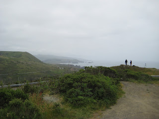
We didn't end up leaving until around 11:30. Once we got on the road, we were passed by packs of cyclists heading south. I guess they were riding the Tour route ahead of the race. The road was back to rolling, but the coast was much different than in Marin County. The coastline itself was mostly low cliffs with rocks jutting out of the water. There also weren't as many trees. Everything appeared windswept, although the air was calm when we passed through.
About 10 miles down the road, we arrived in the small town of Jenner, located at the mouth of the Russian River. We stopped to grab groceries and ran into a few more people interested in our trip. There seem to be more and more the farther away we get from the Bay. Jenner was our last stop before we began a major climb over the Sonoma Bluffs on a winding, narrow stretch of road.
 |
| Leaders of the race |
 |
| High atop the Sonoma Bluffs |
The climbs that followed, over the highest part of the Bluffs, were some of the toughest yet. We first climbed to the junction with Meyers Grade, where the racers had turned onto Highway 1, then after a steep descent through rangeland, we climbed another few hundred feet. With legs burning, we dropped off the north end of the Bluffs to Fort Ross, an old Russian colony. Not surprisingly given my background, we stopped and had a look around. Though mostly reconstructed, the fort was impressive in its remoteness, and with the domed Orthodox chapel, it had a distinctly Russian flavor.
 |
| Look, I geek out whenever I see anything Russian, ok? |
We still had about 8 miles to go until camp, including a grocery stop at the Fort Ross Store. We were back to rolling terrain, albeit more forested than it had been to the south. At about 5:00, we pulled into Woodside Campground at Salt Point State Park and promptly did a hilly lap of the sites before realizing that the hiker/biker sites were right at the entrance. That night was one of the quietest I have ever experienced. Apart from very infrequent 30-second bursts of traffic noise, I barely heard a sound.
View Day 6 - Bodega Bay, CA-Fort Ross, CA in a larger map


No comments:
Post a Comment